Follow me on the CDT #10: Welcome (back) to Wyoming
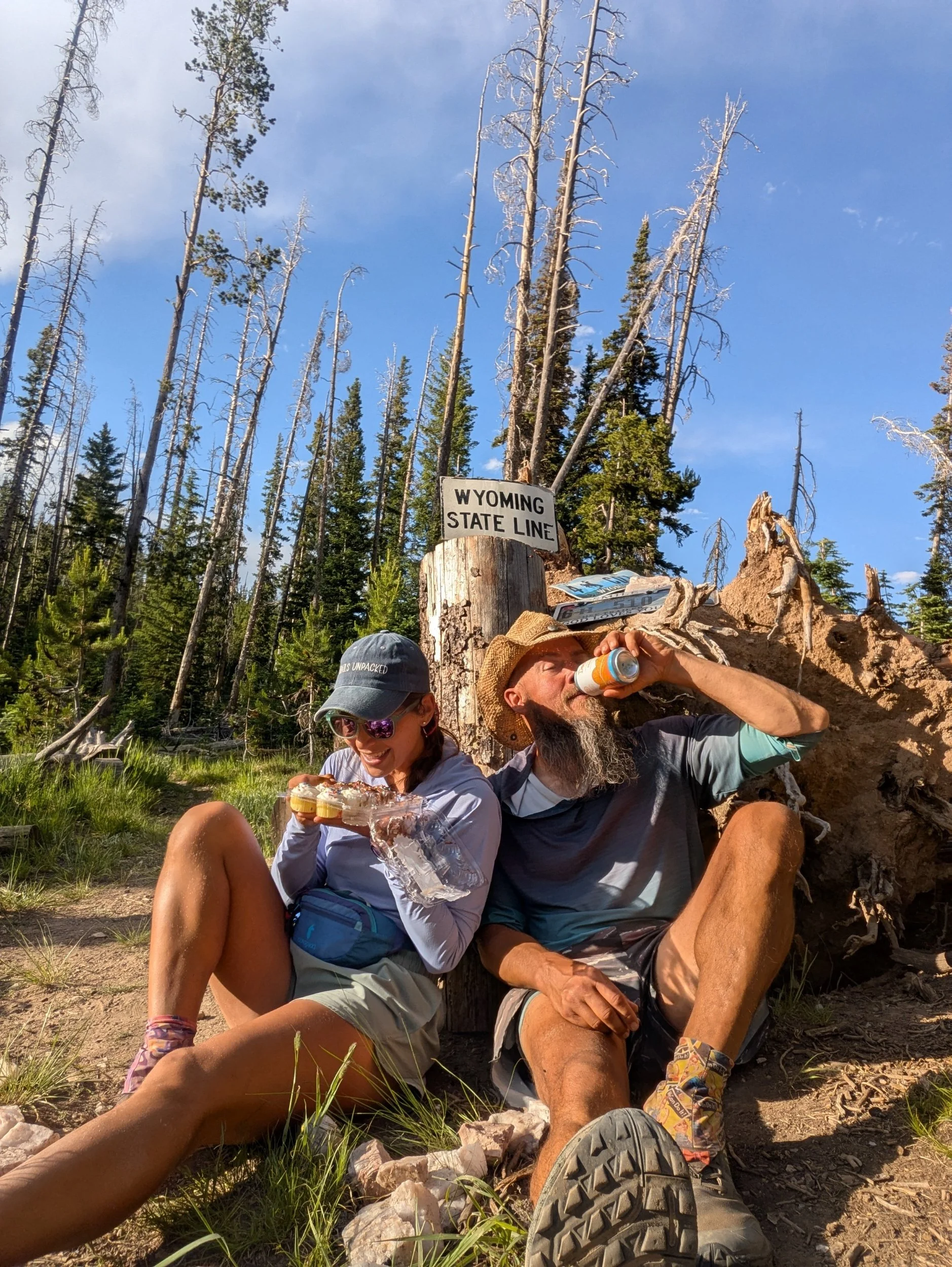
Of all the ridiculous things I've heard of people packing, seen in packs, or myself have carried, this was definitely the top of the list. This morning I found a large Stanley tumbler along the trail. It was dirty and laying close to a bush, obviously lost for a couple days. It was Carolina blue and my Tar Heel self couldn't pass it up. I wiped the mud from it and added the 1lb 6oz cup to my back. My poor pack was already heavier than normal carrying an extra beer and 12-count mini cupcakes. We left Steamboat Springs the day before and had a 100ish mile resupply to the junction in Wyoming where we started the basin back in May. Before that we would cross the Wyoming state line and celebrate 1,500 miles. The extra weight was my supplies for such celebrations.
Steamboat Springs marked the reprieve we had been waiting for. Every time we left a town in Colorado I would tell myself, without any proof whatsoever, that now NOW the trail would be easier. There would be less elevation. It was a lie every time until now. The terrain was a blend of Wyoming and Colorado. High peaks reduced to large hills covered not in trees but boulders and grass that mark Wyoming. It was interesting to FEEL the state change as I walked towards the line.
With the excitement of leaving behind Colorado and the easier hiking, we "just happened" to have 30 mile days back to back to camp right at the border. At 6pm we cracked canned mimosas and ate mini-cupcakes. Colorado my was the hardest state from any thru hike. It cost me blood, sweat, and tears and I'm proud to have completed it.
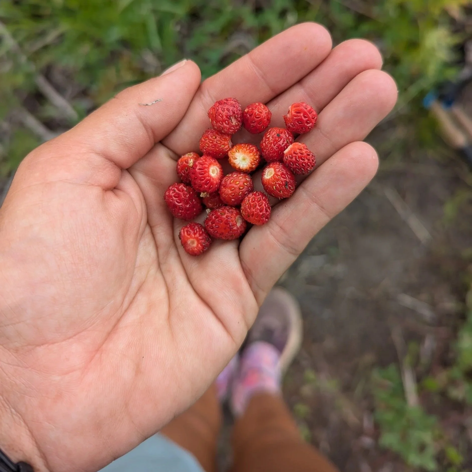
From the border, it was 1.5 days until Jinx would pick us up south of Rawlins. Knowing how the basin looked, I was still having troubles picturing the drastic change in terrain that was to come. The border was hilled with trees… and lots of them. The first day we spent going up-and-down windy trail through forested foothills. After the climb to Bridger Peak the basin started to creep in. The northern side of the peak had more sage brush, gentle slopes, and eventually the trees dwindled. Surprisingly I did see a number of wild strawberries scattered in the sage.

Meeting Jinx, and driving back to Rawlins felt like a mini completion of the trail. My body was sore from Colorado and a zero would be restorative. Jedi was excited for town to eat the burger of all burgers. He has been excitedly describing this "epic" burger to me since the start of trail. It is a cheese burger that instead of buns uses grilled cheese sandwiches. Those grilled cheeses also include a fried egg. Talk about hiker hunger!
The Wind River Range
The Wind River Range is regularly polled as the best part of the CDT by thru hikers. Even though we already paid our dues in the basin, it felt like cheating to be dropped off at South Pass and head north directly into the Winds. The foothills were hot and dusty and hid the secret of what was to come. We took a famous alternate called Cirque of the Towers to see the gemstone of the Winds. The alternate started unassuming, even off putting. We turned off the CDT to head directly UP a valley with no trail and constant blow downs. It wasn't until after a well earned 5 mile struggle that I could see the awe of the Winds starting.
Another benefit of coming straight from Colorado is that the climb up Temple Pass felt minimal. The only time I couldn't catch my breath was at the top of the pass and I saw the Cirque unfolded below me.

There was minimal trail on the ascents and descents but the extra care with every step gave me more time to ogle at my surroundings. The Cirque itself is only 20ish miles long so it is a short 'n sweet time. We pushed to reach a high point toward the middle on Jackass Pass (that is the actual name.) From this vantage we could see either end of the Cirque and was the perfect spot for our one night back there.

Being in northern Wyoming our trail routine was forced to change. We had entered grizzly bear country. While the Winds are not known to have grizzlies (too many people) they have been spotted, so this was the slow roll into safe bear recreating. When we started north at South Pass we added bear cans and bear spray to our gear. Bear canisters are definitely a weight hassle but I prefer them to the alternative throwing a line to hang food every night. In grizzly country, a bear line should hang 10ft off the ground! 10ft! The bear can is a safer bet for me. I also had to ease into a new routine of not eating in the tent. Because the Winds are "griz lite" we set up the tent and moved away from it to eat before storing the cans. In "griz heavy" territory we will eat a couple miles before camp. Goodbye mac&cheese while wrapped in my quilt!
This night was a night when I was glad to be forced outside for dinner. I was dirt tired by the time we reached camp and wanted nothing more than to crawl into the tent. But sitting out on the rocks, looking across the Cirque over instant food was a memory I'll never forget.
The only downside, and I mean only, downside to the Winds is that resupplying is a challenge. To carry enough food all the way through would be around 170ish miles/6-7 days. To resupply in the middle of the mountains, requires 20 bonus miles down side trails to a trailhead. I did see a group of people using llamas as pack animals so they probably had 7 days worth of food, but for the llama-free folks that would be a lot of weight. The bonus miles ended up flying by in our excitement to meet friends, who we found out last minutely would be in Pinedale the same night. After resupplying we camped at a campground at the trailhead. It is amazing how lux a picnic table and privy can feel. Basically the the same as a 4-star hotel!
The remainder of the Winds were as astounding as everyone makes them out to be. I swam in 3 lakes, all chilly, so maybe more of a dip than a swim. The Winds looked like a mash-up of the different Colorado ranges. They have the ruggedness of the San Juans with the valleys of the Collegiates. Each peak was perfectly unique, as if they were molded individually instead of a range. The valleys were deep enough to stay hidden underneath each pass so every incline brought a whole new world at your feet.
The final send-off from the Winds is a mercifully flat, peaceful walk to the Green River Lakes. It is achingly beautiful with Square Top framed in the middle.

Griz Country
The unofficial start of "heavy" griz country is Gun sight Pass, which we climbed first thing in the morning following the day in Green River Lakes. At the top of the pass you have a limited view of the Tetons to the northwest. There was a faint haze starting to settle over the valleys and I wondered when wildfire season would catch us.
After Gunsight Pass the majesty of the Winds vanished completely. It was the Basin 2.0 and I'm giving this the better rating because this basin at least had natural water sources. Flat, yellow grass, sage brush. Yup, it was the basin. The edges of the landscape had small hills dotted with pines but they were peripheral. Being on flat land reminded us that we are the only ones out here because looking in all directions there was no one else. Our only company were biting flies who followed us by the hundreds. Over lunch my fly kill count topped 100.
Eventually we climbed just enough to reach the treed slopes and I experienced a new type of forest. These forests were dispersed with small meadows, full of yellow grass, every so often. Some the meadows were much larger and had you turning around confused as to where exactly is the forest I WAS JUST IN?!
Being in griz country made me nervous as it was my first time taking an extended trip here. Every time we approached a stream with tall willows I clacked my poles in case one was hiding in the brush. A hiker a day in front of us had an encounter with two griz that resulted in him emptying his bear spray (he is okay). The lack of a trail as we plodded closer to Dubois, Wyoming gave me more of a sense that we were encroaching on the bear's territory than they on ours.
Between the overgrown meadows, erratic trees, and burn scars there was no trail for miles to the highway. Several times we found ourselves off the trail because we were following the only path we saw. The afternoon before Dubois, we spent nearly 10 miles on some of the ugliest active logging roads. At least there I was pretty sure I wouldn't run into a bear.
Then just like that we were in Dubois. Hotels were exceedingly expensive for a small Wyoming town but one of the in local churches lets hikers sleep on cots in their community room. Being so far ahead of the bubble now there was only one other hiker the same night as us. It was such a relaxing, peaceful stay and an experience of hospitality you can only get on trail.