Follow me on the CDT #9: The Halfway Point

I waved to Jedi, signaling the need to stop. I was gasping air and felt as if I couldn't get enough to speak. Annoyingly he came to stand beside me and ask without a hint of breathlessness if I was okay. Before I got enough lungfuls to build up my oxygen supply for a reply, I felt a cold, wet prickle on my face. Of course. Of course, it was starting to snow.
We were on the climb up Mt. Elbert. Only 69ft shorter than Mt. Whitney and the 2nd highest peak in the contiguous USA. The CDT passes by the base of the peak and is a common detour for many hikers. We opted to take the route up on the south side of peak and come back down to the CDT via the north side. In CDT miles we would cover 3 trail miles, but hadn't the slightest clue how many miles we were adding by going up and down. Whatever the amount (I looked it up later at it was 9 miles total), it was harder and longer than I anticipated.
There is nothing technical about summiting Elbert. In fact, aside from the altitude the hike up feels unassuming. No traverses, no ledges, just switchbacks up an innocent but steep grassy slope. Yet I was gasping with each step. This was not going to be a quick endeavor. With a little over 1,000ft of climb left, dark clouds were pushing over the top of Elbert and bringing a chill wind. I was hopeful they were all show but internally resigned to the fact it probably meant snow. I hesitated, not just to rest, but to assess our options. Do we stop and shelter here? The mountain itself was blocking the view of what was coming after these clouds.
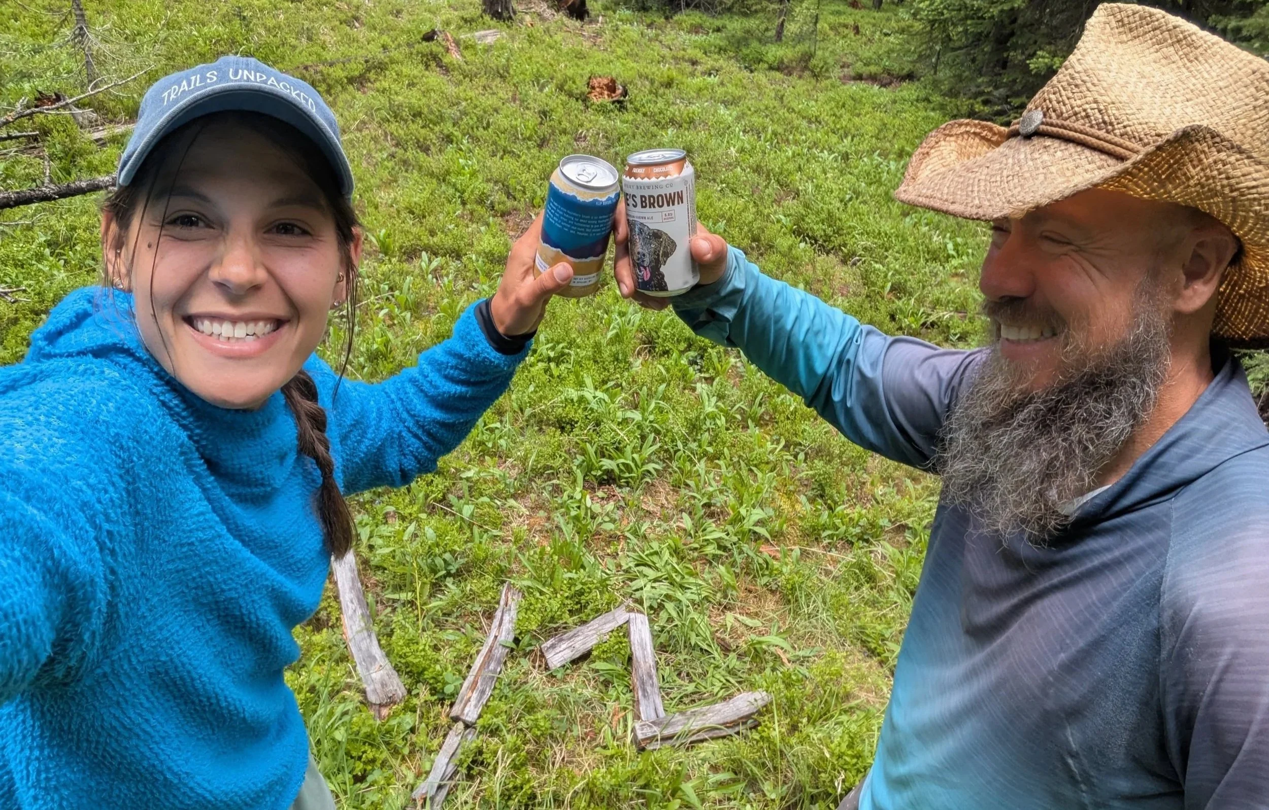
I looked around. We were not the only ones heading up Elbert this morning. There were at least 4 people in front of us and I could see over to the ridge and the northern trail with another handful. Well if it was unsafe to continue at least there would be company. Continuing on was the good choice. The clouds cleared in 20 minutes and it was beautiful summit when I made it gasping to the top. From the south and east you looked over the valley and twin lakes down below. The view to the west and north was unfurling mountain ranges. Snow fleckled most of the peaks still. Quickly the exertion it took to climb drained away as the euphoria of reaching the top mounted. We drank summit beers feeling on top of the world.
The descent took nearly as long as the ascent. The trail was slippery with sand and scree. Even the few steps made out of chicken wire and rocks were perilous for me and I fell on one such step, thudding hard on the wire. It wasn't until noon that we made it back to the CDT. The clouds were rolling in to stay this time. We ate lunch in our ponchos as it started sprinkling, Elbert day hikers giving us quizzical looks when they passed en route to their cars. As we were eating Buffalo Bill caught up to us again. Turns out he was only an hour or so behind us on Elbert. The rest of the afternoon was hiking through tree line along the bases of other 14ers. Rain came and went but no storms.
To Frisco
The next 54 miles to Frisco continued to be long days of vertical gain. We camped one night at the top of Kokomo Pass (elevation 12,024ft). There was by no means any flat ground for comfortable sleeping but there is a conquering feeling setting up your tent at the top of a climb. It was a peaceful night overlooking the valley with a large mine in the distance.
Camping at the top also meant a descent in the morning. There was a significant climb waiting for us on the other side of highway 91 but that was the afternoon's problem. A few miles of the climb down winded through the backyard of Cooper Mountain Ski Resort. After days in wilderness, spent on passes that only backpackers are masochistic enough to hike, it was shock to the system to pass by so much civilization. Snowboarders, mountain bikes, and an entire village that existed feet from trail. I was torn between my desire to rush to a gift store for a soda and my repulsion at the breaking of the solitude I have come to expect on trail. Amenities won out. It was a 0.25 mile detour down a bike path to a gas station for fresh hot dogs and soda.
To save on hotel costs we camped a couple miles back from the trailhead into Frisco. It's a fun treat to wake to less than an hour of hiking before a town breakfast!
In Frisco we said our goodbyes to Buffalo Bill. Jedi and I would be visiting with a tramily member from the AT and PCT in Denver and then take the Silverthorne alt instead of the official CDT.
Silverthorne Alternate
After an impromptu zero we were back on trail! Sort of. Our hotel in Silverthorne was ON the blue line alternate so we stepped out to start hiking immediately. We were in for a tough day. 8,000ft of gain over 21 miles. At that rate I knew we wouldn't make over 20 miles in a single day.
From Slivethorne, the route followed the trail up Ptarmigan Mountain. It was steep and hot and took all morning to reach the first pass. We ate lunch on the grassy slope looking east at Torrey Peak, where the red line takes hikers to the only 14er on trail. Part of our decision to take this route were the comments from other hikers exclaiming the scenery and ruggedness of the alt. Quite a few called it "the adventure route" and we were eager to see something unseen.
The route certainly dived into wilderness quickly after Ptarmigan, but it was an easily followable trail. Over the course of the day we walked along 3 more saddles into one final long valley. The wilderness felt more and more complete the farther we went. Despite there being a trail, there was no sign of other people. The most company we had was a herd of elk grazing just down the slope from us.

As predicted we made it 17 miles. It would have been a bit shorter but the camp spot we were hoping for looked as if every moose in the past 10 years had used that exact spot for a privy. I wasn't sure that if we cleared a spot we wouldn't wake to fresh pellets hitting the tent.
The morning held a 2,500ft ascent up a fire road back to trail and Vasquez Peak Wilderness area. While still steep, fire roads can make for easier climbing without having to dodge rocks or roots. It was the start of one of the most challenging sections of any of my thru hikes. Once on the ridge we had a steep descent over rocks, to only climb again to Stanley Mountain, then down again to a highway pass, then back up to summit Mt. Flora. On Mt. Flora a thunderstorm rolled in. We tried to pick up the pace to avoid lightening up the trail did its best to avoid any open grassy plains and only cross large boulder fields. Every rock was slick with the rain. I weighed the risk between being struck by lightening or a twisting an ankle. In reality there was no way I had the ability to move any quicker across the boulders.

I have been accustomed to inclines being the biggest impediment but here in Colorado, the trail can be tedious anywhere. Up, down, or across. The following day we made better time climbing up James Peak than on the steep decline over rocks and loose dirt.
The long ridge walk following the peak was unique. One side was a long grassy slope to a road and the other a sheer drop to crystal blue alpine lakes. There was no trail to follow so we stumbled over lumpy grass and intermittent rocks. On this ridge we met more CDT hikers than the whole previous week. It was July 2nd and many hikers were making the push to reach Grand Lake, CO for the 4th of July. Fireworks over the lake didn't sound too bad to us either!
We reached Grand Lake the following day on July 3rd. It was 22 miles from where the camped the night before but the miles flew by. Instead of 5k vert, we had less than 2k as the trail meandered around Lake Grandy and the Shadow Lake. It was hot coming down from the mountains and the lakes looked more and more tempting for a break. However as we neared town the amount of people increased with the temperature. It was crowded! Very crowded. Just trying to resupply in the one store was claustrophobic. We decided to head out that night instead and camped right out of town, after a BBQ dinner of course.
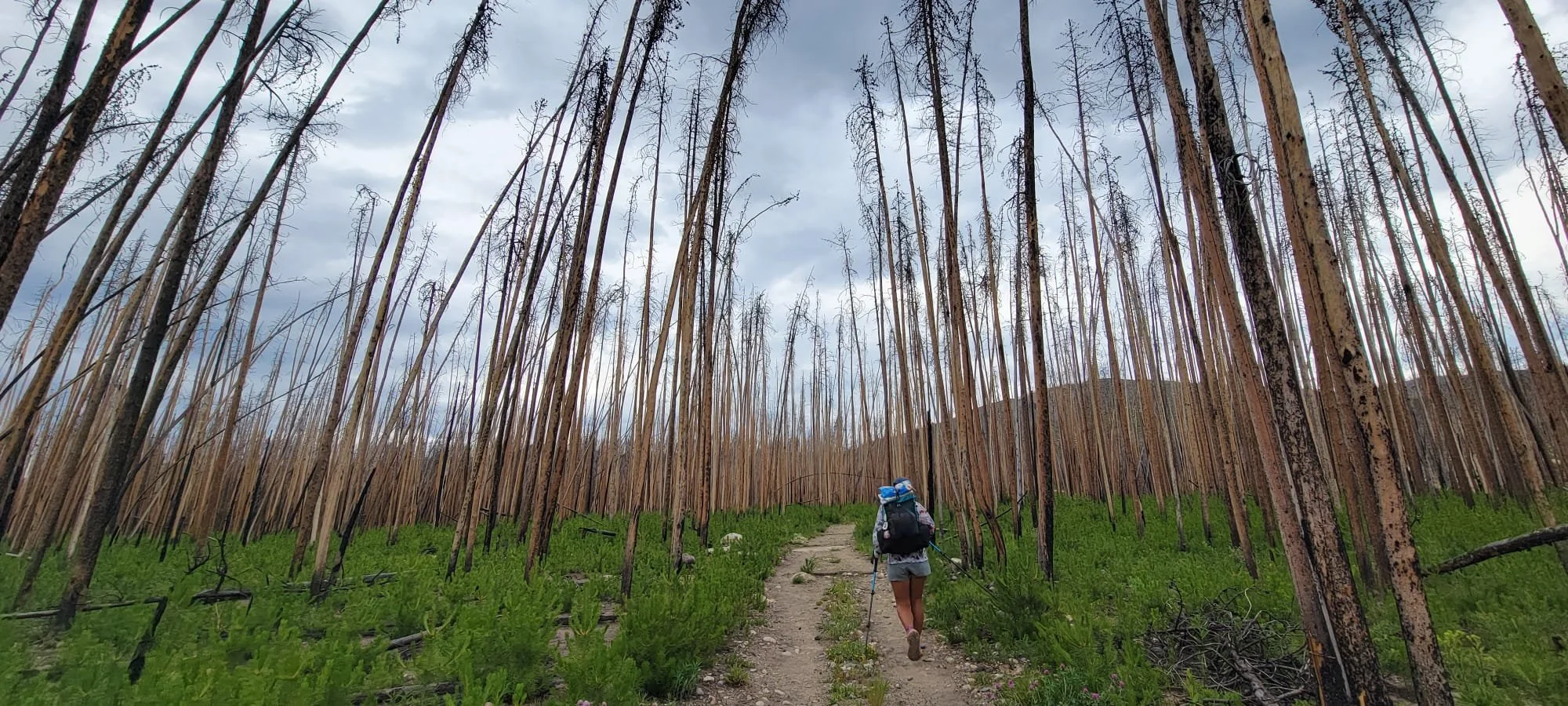
Rocky Mountain National Park sits out Grand Lake and is the first NP for NOBOs. Unfortunately a fire tore through this section of park a few years ago and left a decimated waste land behind. The terrain was so unappealing that we took a cutoff route across the fire area. It rained the entire morning and only added to the depressing nature of the area. My memory of Rocky Mountain will now forever be attempting to eat my breakfast, sitting on a bridge at a trailhead as rain dropped in my coffee.

The tough terrain of Colorado continued all the way to Steamboat Springs, another 70 miles. There was always another mountain pass to climb! On the way we hit 1,400 miles and what we decided to count as our halfway point. With all the different alt options we had no clue what our total mileage would end up.
Exhausted and elevated we made it to Steamboat Springs to meet friends from a previous thru hike. My body was worn but the challenge felt good. Steamboat marked the "cool down." No more 6k gain days! Now just a little further to Wyoming.